
West Seattle, Washington
28 Monday
Think the wind’s been a little wild the last 12 hours or so? Forecast says tomorrow will be even windier — with a high-wind watch now up, and talk of possible gusts to 60 mph in late morning — though here’s hoping the sustained winds will not be October 18-like. (By the way, while the mental image of a blown-into-the-street garbage-can lid is flying by, it’s a good time to note that recycling/trash/yard waste picks up as usual tomorrow even though it’s a government/bank/parking holiday tomorrow.) 5:55 PM ADDENDUM: For those who didn’t make it down to the water today, here’s a little video from the waterfront stairs on the north end of Schmitz Viewpoint along Beach Drive — nothing spectacular but you can hear the wind and see some spray:
More detailed declarations are out today from various local/regional government agencies saying they are all set to handle whatever winter throws at them (oh, say, something icy like the weather that led to the scene below in Upper Fauntleroy last January). Here’s what the state says; here’s what the county says; and here’s how the city puts it. There are some specifics of interest, including, from the county press release: “Through an effort spearheaded by the King County Department of Transportation, cities all across the county have teamed up with Metro Transit and the county’s Roads Services Division to more closely link priority snow removal routes with bus routes.” And from WSDOT’s press release: “This year WSDOT has: installed new, more reliable wind sensors on the SR 520 and I-90 bridges; added new supply stockpiles at locations closer to the roads they serve; added more deicer capacity to dozens of trucks; provided hand-held road temperature sensors to dozens of drivers; incorporated transit routes into snow removal plans; sent more staff to snow college to become better trained in snow fighting; cross-trained additional staff to work in the emergency operations center and serve as plow truck operators Incident Response Team members.” The various agencies also are teaming up on the Take Winter by Storm website. No early November storm in sight at this point, knock wood; the forecast for Friday and beyond looks promising.
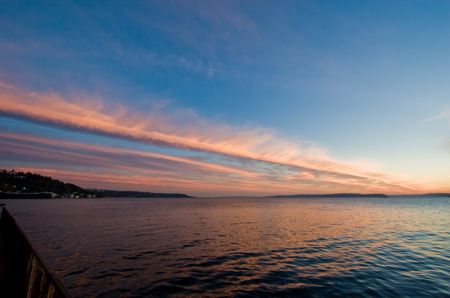
Remember the wild lightning-storm shots last month from Joe LeBlanc? This time (thanks, Joe!), he is sharing incredible views — again from Alki Point — of last night’s sunset:


Before the next round of bad weather smacks us again, two things: First — Two reader recommendation requests, related to roofs. Second — some nice pix from today. We start with the RRRs:
Trevor writes: “The recent wind storm has jiggled a skylight on our roof and now it’s leaking” and is looking “for a reliable West Seattle handyman who isn’t afraid of heights.”
Michell is dealing with roof leaks and writes, “I am looking for a roofing company in West Seattle. Good work and good prices.”
All recommendations in the comments, please. And now – to balance those gray memories of last week’s stormy weather — three photos taken during the glorious afternoon sunshine:


All photos by WSB contributing photographer Christopher Boffoli; the last one, if you were wondering, features the Seattle Fire Department’s Ladder 11 team, training this afternoon near Jack Block Park.
West Seattle’s Most Famous Politician just promised (as detailed in a city press release here) that if anything like last December’s storm happens again this year, we won’t all be left in the dark for so long, literally OR figuratively. Meantime, the storm-related repairs that have been 10 months in the making are finally under way at the Thistle/Northrop sinkhole (full details here) — the heavy equipment arrived a couple hours ago:

Not mega-bad but still formidable wind, plus sideways rain, right now. Weather Service’s forecast warns of showers, isolated thunderstorms, and maybe even (more) “small hail.” (Hope the Lafayette Walk-a-Thon kids have moved into the gym or put things on hold by now?) 12:11 PM UPDATE: Just heard thunder.

Now that power and cable are back for people in the south Morgan Junction/west Gatewood area that was without power till about 5:30 this morning, we seem to have learned about the culprit. Area resident Vlad Oustimovitch sent the photo above (thank you!), explaining it was “a large Big Leaf Maple tree that came down on the 4000 block of SW Orchard Street at 4:15 pm yesterday. It tore out the power and cable lines and blacked out the whole street, and I suspect other streets as well. Nobody was hurt, but there are skid marks 10 feet away from the downed tree where a car driving on the street was almost crushed. I came down soon after, and the driver was shaking as he looked at what just missed him. Crews were out early in the morning and had the street cleared and power on by 5:35 am. Impressive job, they did it all in the dark. Cable was restored a few hours after that.” 5:25 PM ADDITION: One more case of “When Trees Attack!” from yesterday’s storm. Hotwire Coffee proprietor Lora Vickrey e-mailed this photo of the tree that came down outside the Junction post office. Nobody hurt, Lora reports, but some folks passing by at the time were shaken up!

Took one more spin through Fauntleroy/California a short time ago – still out – no City Light crews in sight (but Comcast had a couple trucks a few blocks south). The City Light site says 10,000 people citywide were still in the dark as of 10:30. 11:22 PM UPDATE: One more outage that seems not to be on the city website:Read More
Just got this uploaded; we shot it at the height of the wind craziness:
Just drove through Fauntleroy/California – intersection’s out, most businesses at that spot dark (Thriftway appears to still be on generator power), the businesses along California south of Fauntleroy are out too (Caffe Ladro, Subway, Starbucks, McDonald’s, etc.) though there’s spotty power on some parts of the left side of the street (like the Watermarke condo conversion). Full power picks up right after Seattle International Baptist Church. Going out in a bit to survey the waterfront areas. No wind left, at least. P.S. The City Light outage page doesn’t mention the entirety of this outage – it mentions Myrtle to Othello/38th to 40th (west slope of Gatewood) and Spokane to Charlestown/53rd to 55th.
Some areas of West Seattle are now into a phase of off-and-on-again outages. We will be in transit for a while and checking things out so leaving this post for an “open thread” on what’s happening where you are.
Newest information first: 5:55 PM: The number of people affected by outages in Seattle is starting to drop, so while there’s no definite estimate for when everyone in WS will be back, that’s promising. Watching the barometer suggests the worst is over. 5:30 PM: In addition to the Fauntleroy/California intersection, we saw power out to at least the Seattle International Church vicinity a few blocks south, at last drive-past. 5:26 PM: Comcast cable internet service is out in at least one Upper Fauntleroy neighborhood. 5:18 PM: West Seattle outages on the city list total more than 10,000 homes/businesses. Also — great wave pix up at Beach Drive Blog. 5:00 PM: Power is back on at High Point Community Center. 4:40 PM: Qwest DSL service is reported down in at least one neighborhood near The Junction, though the land-line phones are still working. 4:32 PM: Power is out at the Fauntleroy/California intersection in Morgan Junction. 4:19 PM: Thanks to reader Margelyn for providing the City Light link to the latest outage list. Also, here’s the latest Weather Service “forecast discussion” – analysis to come. 4:14 PM: Update from the City Light hotline, more than 3,300 households/businesses are reported out in various areas of south and east WS; SCL doesn’t know when the power will be restored. 3:59 PM: Adding photo below this post showing tipping power pole that caused the wire trouble on Thistle. Also, report of power out in the High Point Community Center vicinity – activities are still happening but if the power’s not back by dark evening activities might be in jeopardy. 3:50 PM: From reader M, “Stoplights are out starting at Barton & 35th to at least Trenton & 35th (probably further but that is my turn). Arbor Hts Elementary 35th & 104th lost power about 3:15.” 3:25 PM: Reports of tree trouble in The Junction, including one near the Post Office and one in front of Seattle Fish. EARLIER: Washington State Ferries says power is restored at the Fauntleroy dock … City Light has reported various outages on the south side of West Seattle … City 911 reports “wires down” at 4615 SW Thistle, which is just east of Lincoln Park. NOTE: If you have photos of fallen trees or anything else weather-related, please send them in. We will be out and about getting some too, but yours are the best WSB eyes, ears, and cameras!

At least one Weather Service update predicted 2 pm, and indeed, that’s when things kicked up. You can monitor windspeeds here (includes a link explaining the station names; KBFI is Boeing Field and K91S is Alki Point). One comment on our previous post says there’s power out somewhere near Lincoln Park. Also, we have a storm-related bulletin from elsewhere in south WS: The goats coming to Gatewood Elementary to munch invasive ivy are delaying their arrival till tomorrow because of the weather, but everything should be great for the big highlight event on Saturday.
The “wind advisory” mentioned earlier remains in effect. But for everybody stuck outside West Seattle right now, here are a couple shots from Lowman Beach a little while ago … even a little blue sky through a hole in the clouds to the west:


This just in from Seattle Public Utilities: City admits it can’t keep up with drain-clearing and needs “Adopt-a-Drain” volunteers. They’ll send supplies.

The National Weather Service has just published its midmorning “forecast discussion,” and it seems to be in line with the overnight change to a “wind advisory” — this afternoon’s wind in our area likely to be 20-30 mph “sustained” with maybe some 40, 50 mph gusts — not to be taken lightly, but also probably not hugely catastrophic. Excerpt:
THE INTERIOR WILL SEE THE STRONGEST WINDS DURING THE MID AFTERNOON AND EARLY EVENING WITH SOUTH TO SOUTHWEST WINDS 20 TO 30 MPH WITH GUSTS 40 TO 50 MPH. ASIDE FROM STRONG WINDS IN THE STRAIT…WILL SEE WINDS DIMINISH ACROSS THE AREA THIS EVENING …AS THE LOW EXITS THE REGION. THIS SYSTEM IS ALSO BRINGING PRETTY GOOD PRECIP TO THE AREA WITH RAIN…MODERATE AT TIMES…SWITCHING TO SHOWERS DURING THE AFTERNOON.
If you don’t always pay such close attention to weather details … south-to-southwest wind means that west- and south-facing areas of WS (as well as the higher hills) are likely to see more of it than north-facing areas such as Alki.
The National Weather Service has canceled the “high wind watch” and issued a “wind advisory” in its place — the predictions are a little less dire, and the strongest gusts are now expected to be not as strong as first feared:
THE NATIONAL WEATHER SERVICE IN SEATTLE HAS ISSUED A WIND ADVISORY…WHICH IS IN EFFECT FROM 2 PM THIS AFTERNOON TO 11 PM PDT THIS EVENING. THE HIGH WIND WATCH IS NO LONGER IN EFFECT.
WINDS WILL INCREASE OVER MOST OF THE LOWLANDS THIS AFTERNOON RIGHT AHEAD OF THE INCOMING WEATHER SYSTEM. SOUTH WINDS IN THE 10 TO 20 MPH RANGE WILL INCREASE TO 20 TO 30 MPH WITH GUSTS TO 40 MPH BETWEEN 2 PM AND 8 PM. THE WINDS WILL DECREASE SIGNIFICANTLY AFTER 11 PM.
According to the accompanying “forecast discussion” from early this morning, the rain might be more worrisome than the wind, at this point, with up to an inch likely in the city today.
The National Weather Service‘s nighttime “forecast discussion” is online now, and the predictions haven’t changed much. The strongest wind tomorrow is expected out at the (ocean) coast and up Whatcom/Skagit/Whidbey way, but we’re still likely to get gustiness here in the big city. Excerpt, including talk about a second storm to follow:
PLENTY ENOUGH SUPPORT FOR THE CURRENT FORECAST WITH WARNING CRITERIA (GREATER THAN 40 MPH SUSTAINED AND/OR GUSTS 58 MPH OR MORE) OVER THE COAST AND NW INTERIOR. STILL IFFY IF THE CRITERIA WILL BE MET ELSEWHERE…BUT IT WILL BE WINDY REGARDLESS. ENOUGH FOR AN ADVISORY ANYWAY. THE STRONG WINDS WILL LAST THROUGH A LARGE PART OF THE DAY FOR THE COAST…WITH THE STRONGEST WINDS OVER THE INTERIOR DURING THE MID AFTERNOON INTO THE EARLY EVENING…THEN EASING UP INTO THE LATE EVENING HOURS.
ON FRIDAY…ANOTHER SYSTEM WILL MOVE INTO THE AREA WITH PLENTY OF RAIN AND CLOUDS AND CONTINUED COOL TEMPERATURES. WIND WISE…THIS SYSTEM LOOKS A GOOD DEAL WEAKER THAN THE THURSDAY SYSTEM…BUT IT WILL HAVE A DECENT SW BREEZE IN ITS WAKE. THE OFF AND ON WET WEATHER IS EXPECTED TO CONTINUE INTO THE EARLY PART OF THE WEEKEND.
First — King County leaders have chimed in, including preparedness advice; read it here. (Helpfully, that page includes this link to more information about food spoilage when your fridge loses power; that was a big point of confusion for us and others during the longterm outage last year.)
Second — the city Transportation Department issued this alert, including a phone number that is worth writing down someplace:
Stormy conditions are forecast for tomorrow’s afternoon commute period. An abundance of leaves brought down by the wind and rain may clog street drains and result in spot flooding. Drivers should use caution and proceed slowly where water has accumulated on the roadway, and should not drive through deep water.
In the event of heavy winds, trees and branches or other debris may fall into the roadway, and power may be lost in some areas. Drivers should be alert for obstacles on the roadway, and treat dark or twisted traffic signals as all-way stops. Blocked roadways, damaged traffic signs or malfunctioning traffic signals within the City of Seattle may be reported to SDOT’s 24-hour Street Maintenance Office at 206.386.1218.
Today SDOT crews readied equipment and supplies to prepare for tomorrow’s forecast of bumpy weather. The crews are ready to clear roads of storm debris, repair damaged traffic signals and signs, and work with other city departments to keep roads open and power on throughout the city.
Press release just out of the inbox. Please note the line about the trees — go check yours if applicable:
With a windstorm expected in the greater Seattle area Thursday evening, Seattle City Light is preparing crews and stocking its trucks to respond to any outages that occur and restore service.
The National Weather Service is forecasting sustained winds of 25 to 35 mph and gusts of 40 to 50 mph. The peak of the storm is expected between 3 p.m. and 9 p.m.
Winds of that level are slightly stronger than a typical winter storm in this area. They have the potential to damage the electrical system, causing outages.
One particular concern is trees that were damaged in last December’s major storm but are still standing. Those trees have been weakened and are more susceptible to wind. Also, because many of the trees still hold a majority of their leaves, they act more like a sail in catching the wind, further increasing the risk.
On the good side, soils are not saturated, giving trees more of an anchor. City Light also has trimmed trees along more than 100 miles of power lines this year to provide clearance that helps reduce the likelihood of damage.
Residents are encouraged to take this opportunity to get prepared for winter storms and other emergencies. Three ways you can begin preparing today are to make an emergency plan for your family, build an emergency kit and get involved with your neighbors.
You can learn more at www.seattle.gov/emergency.
The National Weather Service has just published its latest “forecast discussion,” and it’s still calling for strong winds tomorrow afternoon/evening:
THE STRONGEST WINDS IN THE PUGET SOUND AREA WILL OCCUR DURING THE LATE AFTERNOON AND EARLY EVENING. AS FOR HOW STRONG…IT ALL DEPENDS ON HOW TIGHT THE SOUTH TO NORTH PRESSURE GRADIENT IS…WHICH DEPENDS ON THE TRACK OF THIS SYSTEM AS IT MOVES ONSHORE. AT THIS TIME WE ARE EXPECTING SOUTH TO SW WINDS 25 TO 35 MPH WITH GUSTS TO 50 MPH FOR THE INTERIOR.”
While we await the next update on the High Wind Watch that’s in effect for tomorrow for most of the region — we just got a beautiful photo of yesterday’s stunning sunrise, courtesy of Steve Fischer, who took pix while waiting for the Water Taxi.

From the link we mentioned earlier this morning, where National Weather Service meteorologists elaborate at least twice daily on what they see heading this way, the newest “forecast discussion” is now published, including this excerpt, referring to tomorrow (Thursday): “FOR THE PUGET SOUND AREA…APPEARS THAT THE STRONGEST WINDS WILL OCCUR DURING THE LATE AFTERNOON AND EARLY EVENING HOURS AS A STRONG SOUTH TO NORTH PRESSURE GRADIENT DEVELOPS.”
| Comments Off on Blustery Monday on the way, including a High Wind Watch